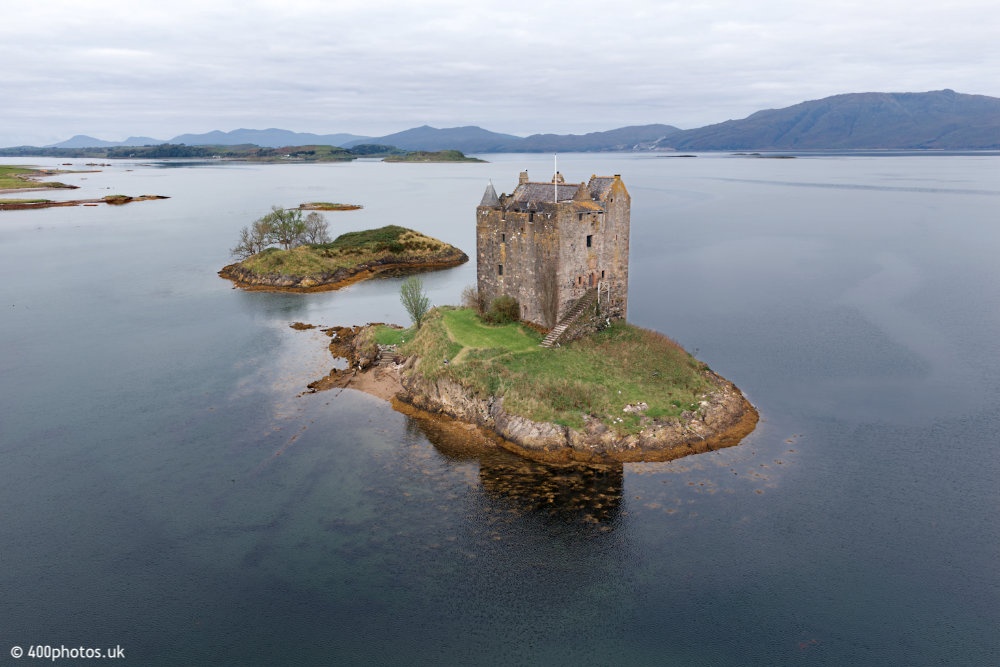
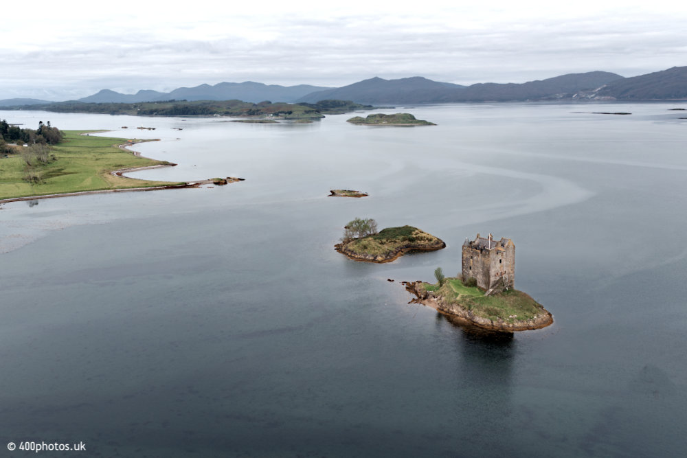
Castle Stalker
Appin, Argyll and Bute


This view is looking across Loch Linnhe with Kingairloch Church and Glengalmadale clearly
visible five miles away.
The mountain on the right (north-west) is Creach Bheinn at 2,798 feet.
Its peak is about seven miles away but about thirty by road and ferry.
The mountain on the right (north-west) is Creach Bheinn at 2,798 feet.
Its peak is about seven miles away but about thirty by road and ferry.
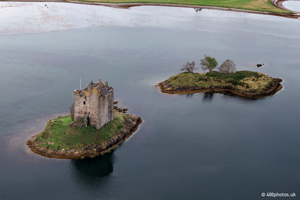
The castle sits on an island named Eilean an Stalcaire and the smaller
one nearby is Eilean a' Ghaill.
Stalcaire translates as hunter or stalker, hence the name.
Parking nearby is very limited but there's a café a half mile or so north with good views of the castle, parking and a path down to the shore.
Stalcaire translates as hunter or stalker, hence the name.
Parking nearby is very limited but there's a café a half mile or so north with good views of the castle, parking and a path down to the shore.
Castle Stalker dates back all the way to around 1320 and has, to put it mildly,
an interesting past involving several families and many changes of
ownership.
Seemingly you can book visits and tours by the current owners in summer months.
Seemingly you can book visits and tours by the current owners in summer months.
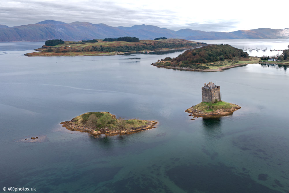
The castle is in shallow water in a sheltered bay on the eastern shore of Loch Linnhe,
a mile or so north of Port Appin in Argyll & Bute.
Shuna is in the middle distance and that's Linnhe Marina to the right.
Shuna is in the middle distance and that's Linnhe Marina to the right.
The Appin peninsula on the left (south) and on the horizon the view across Loch Linnhe
towards Glensanda Quarry on the Kingarloch coast of the mainland Morvern peninsula.
That's the island of Lismore in the left middle distance.
That's the island of Lismore in the left middle distance.